Cal Poly Project Could Help Communities Recover from Wildfires — Using AI
A pair of Cal Poly professors and a team of students have used artificial intelligence to train a computer to quickly assess wildfire damage — potentially improving response time for efforts to recover from major wildfires.
Accurate and timely damage assessment has become critical for response and recovery as the threat of wildfires increases. Damage assessment reports inform first responders’ strategies, affect residents’ ability to file insurance claims, and guide state and federal authorities’ plans for future disaster relief and financial aid.
To date, most wildfire event inspectors must personally visit affected areas and manually document the severity of building damage, a process that often takes weeks.
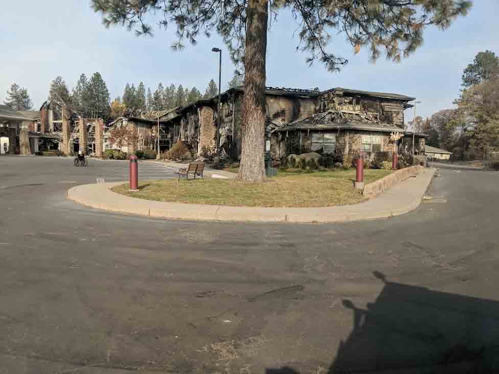
Social sciences Assistant Professor Andrew Fricker, computer science Assistant Professor Jonathan Ventura, visiting Cal Poly undergraduate student Gustave Rousselet, and a team of Stanford doctoral students sought to streamline this process with artificial intelligence (AI) deep learning. Their project, DamageMap, involved training a computer to identify wildfire damage from aerial photos. When tested on images from California’s Camp Fire and Carr Fire, DamageMap produced results that were over 90% accurate as compared to official damage reports.
For Fricker, the problem had become personal.
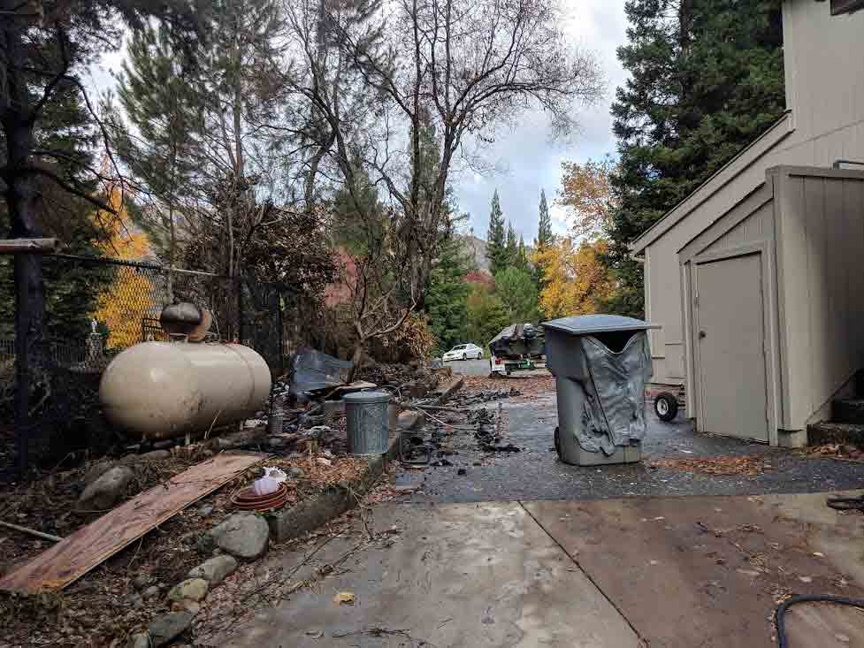
“I really wanted answers about what had happened to my childhood home in the wake of the Camp Fire (the worst in California history to date),” he said, “and it took weeks to find out what happened. Tens of thousands of others were in my position as well.
“Meanwhile, people are living out of their cars in the Walmart parking lot, waiting for answers. If your home burned down, you could get an insurance payment for a hotel room, a vehicle or whatever you needed to start rebuilding your life. But you can’t get that insurance payout until you can prove your home has been destroyed. Hence, the need for a faster flow of information and a rapid assessment.”
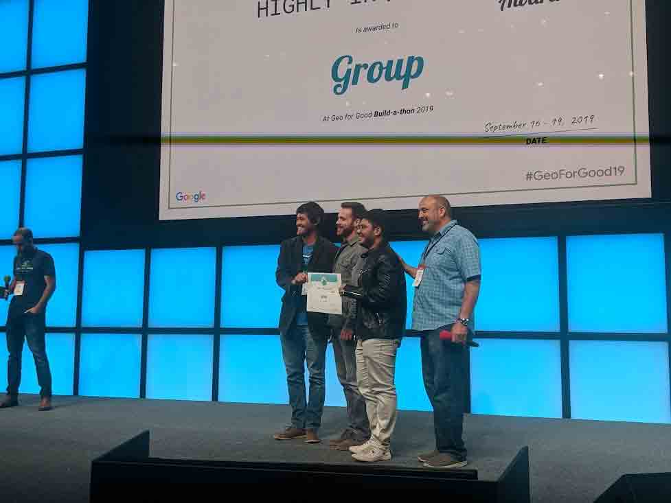
Fricker used funding from a Cal Poly Research, Scholarly and Creative Activities (RSCA) grant to gather data, hire student research assistants, and attend Google’s Geo For Good conference in 2019, when DamageMap won the Highly Inquisitive group award in a build-a-thon competition.
While previous AI technologies have compared pre-fire and post-fire aerial photos to assess damage, they have been unable to effectively meet the growing need for disaster reporting. Without deep learning, pre-fire and post-fire photo conditions must match as closely as possible to reliably analyze damage.
This requires frequent surveys in fire-prone areas, making the technology difficult to implement. However, DamageMap only requires post-fire aerial photos and could potentially scale up for wider use in wildfire damage reporting to help provide aid sooner.
“If we could develop a tool to use remote sensing and artificial intelligence to shorten assessment time, theoretically we get victims faster answers –– and potentially get some money in the pockets of those who need it most,” Fricker said.
Don't want to miss any cool Cal Poly News stories? Sign up for our monthly newsletter, the Cal Poly News Recap!